
Counting cattle with drones: how accurate is it, and what are the rules?
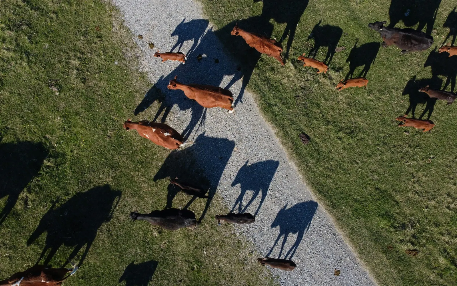
Yes, drones can count cattle, and in published trials the counts came close to the real number when the animals stood still. Across 12 survey flights on a Brazilian farm, drone photos and counting software estimated 935 head against an actual 989, about 94.5% of the true total (our arithmetic) (Barbedo et al. 2020). In Japan, counts of still cattle were within 3 head of the truth for dozens of animals, but when cattle walked during the flight some counts came out about 1.5 times too high (Shao et al. 2020). Before you fly, check your drone rules: in Australia a landholder can fly a drone of more than 2 kg up to 25 kg over their own land without a remote pilot licence, as long as nobody is paid for it (CASA 2024a).
Can drones count cattle accurately?
Research says yes, under the right conditions. A drone (also called a UAV, short for unmanned aerial vehicle) takes overlapping photos of the paddock. Software then finds each animal in each photo and works out which ones it has already seen, so nothing is counted twice. The table below sets out what peer-reviewed studies have reported, with the conditions that matter.
| Study | Where and how | Reported result | Conditions |
|---|---|---|---|
| Shao et al. 2020 | Pasture in Aso, Kumamoto, Japan. DJI Phantom 4 at about 50 m, 80% photo overlap | Detection precision 0.957, recall 0.946. Counts at most 3 out for dozens of cattle, zero double counts | Only when every animal moved less than its body length during the flight |
| Shao et al. 2020 | Same pasture, different area and season | Detection F-measure fell to 0.713 | Background the software had not been trained on |
| Barbedo et al. 2020 | Canchim farm, São Carlos, Brazil. Flights at 30 m, 70% overlap | 935 estimated against 989 actual over 12 dates | One date with several young calves: 199 estimated against 242 actual |
| Xu et al. 2020a | Quadcopter images of pasture and feedlot cattle | Counting accuracy of 94% on pastures and 92% in feedlots | Offline quadcopter vision system; figures from the abstract only |
| Xu et al. 2020b | Private farm in Armidale, Australia. DJI Mavic Pro video | Counting accuracy 94.7% for cattle and 97.3% for sheep | Tested on 200 cropped video frames, not whole paddocks |
Two terms help here. Precision is the share of things the software called a cow that really were cows. Recall is the share of real cows the software found. A count can still be wrong even when both are high, because one animal can be photographed several times as the drone passes over.
In the Brazilian study, leaving out the calf-heavy date, the estimates were 736 against 747 actual, about 98.5% (our arithmetic) (Barbedo et al. 2020). The authors expect accurate estimates "under normal population densities of up to four animals per hectare", which is about 1.6 head per acre (our arithmetic).
How does drone cattle counting work?
Most systems follow the same three steps. First, the drone flies a set path and takes photos that overlap, so no part of the paddock is missed. Second, a convolutional neural network (CNN, a type of computer program that learns to recognise shapes from thousands of labelled examples) marks each animal it finds. Third, the software merges the photos so an animal seen in three pictures is counted once.
That third step is harder than it sounds. Shao and colleagues found that stitching photos as if the paddock were flat failed on hilly country, so they built a 3D model of the ground from the same photos and merged detections that landed close together on it (Shao et al. 2020). Barbedo's team instead matched features between neighbouring photos and removed animals in zones already covered by an earlier image, with special handling for animals cut off at an image edge (Barbedo et al. 2020).
The computer side of this is covered in more depth in our guide to how accurate AI livestock counting is.
What makes a drone cattle count go wrong?
Cattle that move
A drone survey takes minutes, and cattle walk. When all animals stayed within a body length, the Japanese system was close to the true count. When some moved further, "results that are about 1.5 times of the true value are observed" in some flight sections (Shao et al. 2020). The Brazilian team also said its method of dealing with overlap "is susceptible to errors due to significant animal movement" (Barbedo et al. 2020).
Animals bunched together
Cattle standing in a tight group are hard to split into individuals. In Brazil, errors rose as clusters got bigger, and the worst single-image error was 20 head short, in a picture full of young calves that "tend to remain undetected when touching other animals" (Barbedo et al. 2020). A Spanish team at the University of Salamanca found most errors came in crowded frames with 10 or more animals in view; with fewer than 10, accuracy rose to 98.78%, while animals in clusters were identified with 87% accuracy (Rivas et al. 2018).
Colour, glare and blur
Light, sun-reflecting patches of bare soil can look like pale cattle, and some yellowish animals blended into dry pasture (Barbedo et al. 2020). In an earlier study by the same group, most detection errors came from severe glare off the ground and from very blurred photos (Barbedo et al. 2019).
A paddock the software has never seen
When the Japanese system was tested on a different area and season of the same farm, its detection score dropped from 0.952 to 0.713. The authors suggest more training photos with different backgrounds would help (Shao et al. 2020). Barbedo's team noted that other breeds would probably need new models to be trained (Barbedo et al. 2019).
Trees and sheds
Few trees appeared in the Brazilian photos, so their effect was small. The authors warn that areas with heavy tree cover "may require some kind of statistical correction to account for occluded animals", which they did not test (Barbedo et al. 2020).
How high should a drone fly to count cattle?
The Brazilian team flew at 30 m (about 98 ft, our arithmetic), which gave about 1 cm of ground per image pixel, and the cattle "showed no reaction when the aircraft flew over them" (Barbedo et al. 2019). When they simulated coarser pictures, 12 of the 15 networks they tested did best at 2 cm per pixel, so they concluded "we could fly twice as high (thus covering a much larger area) without losing any accuracy" (Barbedo et al. 2019). The Japanese team flew at about 50 m, with each photo covering about 80 m by 60 m (Shao et al. 2020).
Your camera, drone and software will change the best height, so treat these as examples from two studies, not a rule. Whatever height you choose, the legal limits below still apply.
Do I need a licence to fly a drone over my own farm in Australia?
Not always. The Civil Aviation Safety Authority (CASA) has a landowner or "private landholder excluded category". You can fly a drone that weighs more than 2 kg but not more than 25 kg "over your own land for business or as part of your job, provided you do not accept any type of payment for the services", without a remote pilot licence (RePL) or operator's certificate (CASA 2024a). CASA lists "crop, livestock or equipment inspections" as an example. You must still get an aviation reference number, get an operator accreditation, register the drone, keep records and fly within the standard operating conditions (CASA 2024a).
Drones of 2 kg or less can be flown for business under the sub-2 kg excluded category, with the same accreditation and registration steps. A medium drone of more than 25 kg up to 150 kg can also be flown over your own land, but you need a RePL for it (CASA 2024a).
CASA's standard operating conditions include flying within visual line of sight, "at or below a height of 120 m by day", and not within 30 m of a person not involved in the flight (CASA 2024b). Small and medium excluded operators must keep a log of each flight (CASA 2024b). If you fly for paid work or business in any other way, you must register the drone and hold an operator accreditation or remote pilot licence (CASA 2024c). Check the CASA pages for your own situation; this is a summary, not legal advice.
What are the drone rules for farmers in the US and UK?
United States: FAA Part 107
The Federal Aviation Administration (FAA) says anyone who flies "for commercial, government, or any other non-recreational purposes" must follow the rules for certificated remote pilots and register all drones under 55 pounds (about 25 kg, our arithmetic) (FAA 2024). To get a Remote Pilot Certificate you must be at least 16 and pass the FAA knowledge test, and registration "costs $5 and is valid for 3 years" (FAA 2025). Drone pilots must keep the drone within visual line of sight and stay below 400 feet (FAA 2024).
United Kingdom: Civil Aviation Authority
The UK CAA's Open Category covers most leisure flying and "low-risk commercial activities" (UK CAA n.d.c). For a drone of 250 g to under 25 kg you need both a Flyer ID, which shows you passed the basic competence test, and an Operator ID, and you must be 18 or over to get an Operator ID (UK CAA n.d.a). You must keep the drone below 120 m (400 ft) and, outside the smallest classes, at least 50 m from uninvolved people (UK CAA n.d.b). Check the CAA pages for the category that fits your drone.
Is a drone the right way to count your cattle?
The studies above show drones work best when cattle are spread out and calm, the light is even, and the software has been trained on similar country. They struggle with tight mobs, young calves tucked against cows, moving stock and tree cover.
Counting through a race or gate is covered in our guide to how to count cattle. If you are searching a large block for stragglers, see how to find lost cattle.
A phone photo is another option for a mob you can see from one spot. Count My Herd is a phone app that counts cattle, sheep, horses or goats in a few paddock photos and gives a range around the count. In our first check, 9 small groups of animals (1 to 7 head, one photo each) were all counted exactly. Big mobs and sweeps of several photos have not been tested yet, and it is an estimate, not a count through the race.
Common questions
Can drones count cattle?
Yes, with counting software. Across 12 flights on a Brazilian farm, drone photos gave an estimate of 935 head against 989 actual. In Japan, counts of still cattle were at most 3 head out for dozens of animals. Results drop when cattle move during the flight, bunch together or include young calves.
How accurate is drone cattle counting?
Under test conditions, one study reported counting accuracy of 94% on pastures and 92% in feedlots, and an Australian study reported 94.7% for cattle on cropped video frames. Moving cattle pushed some counts in a Japanese study to about 1.5 times the true number, and calves touching other animals were counted properly only 71% of the time.
Do I need a licence to fly a drone over my own farm in Australia?
Not a remote pilot licence, for a drone of more than 2 kg up to 25 kg flown over your own land when nobody is paid. CASA calls this the private landholder excluded category. You still need an aviation reference number, operator accreditation, a registered drone, flight records and CASA's standard operating conditions, including 120 m by day.
What are the drone rules for farmers in the US?
The FAA says flying for any non-recreational purpose falls under the rules for certificated remote pilots, known as Part 107. You must be at least 16, pass the FAA knowledge test and register drones under 55 pounds, which costs $5 for 3 years. Keep the drone in sight and below 400 feet.
How high should a drone fly to count cattle?
It depends on the camera and software. A Brazilian team flew at 30 m and the cattle showed no reaction. Their tests found 2 cm of ground per pixel worked best, so they could fly twice as high without losing accuracy. A Japanese team flew at about 50 m. Legal limits are 120 m in Australia and the UK.
References
- Barbedo, J.G.A., Koenigkan, L.V., Santos, P.M. and Ribeiro, A.R.B. (2020) 'Counting cattle in UAV images: dealing with clustered animals and animal/background contrast changes', Sensors, 20(7), 2126. Available at: https://doi.org/10.3390/s20072126 (Accessed: 17 October 2026).
- Barbedo, J.G.A., Koenigkan, L.V., Santos, T.T. and Santos, P.M. (2019) 'A study on the detection of cattle in UAV images using deep learning', Sensors, 19(24), 5436. Available at: https://doi.org/10.3390/s19245436 (Accessed: 17 October 2026).
- CASA (2024a) 'Drone weight categories and requirements', Civil Aviation Safety Authority. Available at: https://www.casa.gov.au/drones/operator-accreditation-certificate/drone-weight-categories-and-requirements (Accessed: 17 October 2026).
- CASA (2024b) CASR Part 101 micro and excluded remotely piloted aircraft operations: plain English guide, version 2.2. Civil Aviation Safety Authority. Available at: https://www.casa.gov.au/sites/default/files/2021-08/part-101-micro-excluded-rpa-operations-plain-english-guide.pdf (Accessed: 17 October 2026).
- CASA (2024c) 'Drone safety rules', Civil Aviation Safety Authority. Available at: https://www.casa.gov.au/drones/drone-rules/drone-safety-rules (Accessed: 17 October 2026).
- FAA (2024) 'Getting started', Federal Aviation Administration. Available at: https://www.faa.gov/uas/getting_started (Accessed: 17 October 2026).
- FAA (2025) 'Certificated remote pilots including commercial operators', Federal Aviation Administration. Available at: https://www.faa.gov/uas/commercial_operators (Accessed: 17 October 2026).
- Rivas, A., Chamoso, P., González-Briones, A. and Corchado, J.M. (2018) 'Detection of cattle using drones and convolutional neural networks', Sensors, 18(7), 2048. Available at: https://doi.org/10.3390/s18072048 (Accessed: 17 October 2026).
- Shao, W., Kawakami, R., Yoshihashi, R., You, S., Kawase, H. and Naemura, T. (2020) 'Cattle detection and counting in UAV images based on convolutional neural networks', International Journal of Remote Sensing, 41(1), pp. 31 to 52. Available at: https://doi.org/10.1080/01431161.2019.1624858 (Accessed: 17 October 2026).
- UK CAA (n.d.a) 'Getting what you need to fly legally', The Drone and Model Aircraft Code, UK Civil Aviation Authority. Available at: https://www.caa.co.uk/drones/open-category/drone-code/getting-what-you-need-to-fly-legally/ (Accessed: 17 October 2026).
- UK CAA (n.d.b) 'Where you can fly (points 3 to 9)', The Drone and Model Aircraft Code, UK Civil Aviation Authority. Available at: https://www.caa.co.uk/drones/open-category/drone-code/where-you-can-fly-points-3-to-9/ (Accessed: 17 October 2026).
- UK CAA (n.d.c) 'Open Category', UK Civil Aviation Authority. Available at: https://www.caa.co.uk/drones/open-category/ (Accessed: 17 October 2026).
- Xu, B., Wang, W., Falzon, G., Kwan, P., Guo, L., Chen, G., Tait, A. and Schneider, D. (2020a) 'Automated cattle counting using Mask R-CNN in quadcopter vision system', Computers and Electronics in Agriculture, 171, 105300. Available at: https://doi.org/10.1016/j.compag.2020.105300 (Accessed: 17 October 2026).
- Xu, B., Wang, W., Falzon, G., Kwan, P., Guo, L., Sun, Z. and Li, C. (2020b) 'Livestock classification and counting in quadcopter aerial images using Mask R-CNN', International Journal of Remote Sensing, 41(21), pp. 8121 to 8142. Available at: https://doi.org/10.1080/01431161.2020.1734245 (Accessed: 17 October 2026).